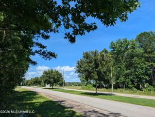
Sister Mary Ellen Road, Kiln, MS 39556
 Land
Land  Built in ——
  0.72acre lot
 —— car garage
  $——/sqft
  Listed 13 days ago
Property Description
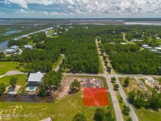
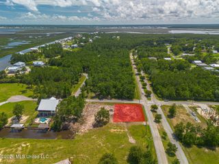
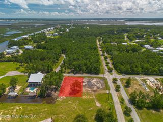
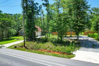
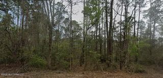
Enjoy peaceful county living on Sister Mary Ellen Rd in Hancock County! This partially cleared +/- 0.72-acre lot offers approximately 145.43 feet of frontage on Sister Mary Ellen Rd and provides a great opportunity to build, place a mobile home, or create your own rural homestead. Zoned A-1, the property allows for a variety of uses including agriculture, mobile homes, single-family residential, and more. Located in the sought-after X flood zone, this lot offers easy access to Kiln Delisle Rd while still giving you that quiet country feel. Public sewer and community water are available but will need to be connected. Looking for more space? The neighboring lot is also listed for sale separately, creating the option to expand your homesite or investment opportunity. Buyer and buyer's agent to verify all information including but not limited to lots lines, zoning, utility availability, connection requirements, flood zone, taxes, lot dimensions and intended use.
- Listing Status:
- Active
- Date Added:
- June 10, 2026
- Data Last Updated:
- June 23, 2026 at 5:40PM
- Listing Office:
- HL Raymond Properties, LLC : 228-466-6643
- Listing Agent:
- Darienne Stuart : 228-225-2608
- MLS ID:
- 4152267
- Road/Access: County Road
- Originating MLS: MLS United
- County: Hancock
- Zoning: (.72+/- Acre) REMAINDER PARCEL: BEGINNING at a found ½" iron rod on the easterly margin of Sister Mary Ellen Road accepted as being 160.5 ft. South and 945.9 ft. East of the ½ Section Corner on the East Line of Section 30Township 7 SouthRange 14 Westsaid point also being on the West Line of Lot 13 of the J. B. Necaise Claim in the aforesaid Township 7 SouthRange 14 WestHancock CountyMississippi; thence along the easterly margin of Sister Mary Ellen RoadNorth 03°07'06" East 145.43 ft. to a found ½" iron pipe on the southerly line of Lot 1Shady Oaks Place Subdivision; thence along said lineSouth 83°31'08"E 200.90 ft. to a found ½" iron rod on the line between Lots 10 and 11 of the aforesaid J. B. Necaise Claim; thence along said lineS 00°06'39" East 160.25 ft. to a set capped ½" iron rod; thence N 79°42'57" West 211.23 ft. to the POINT OF BEGINNING; Containing 0.72 acresmore or lessand being part of Lot 11 of the J. B. Necaise Claim in Section 38Township 7 SouthRange 14 WestHancock CountyMississippi.Part Of Parcel# 069g-0-38-023.000
- Current Use: Vacant
- Water: Community
- Sewer: Public Sewer
- Source: MLS United
This listing courtesy of Darienne Stuart , HL Raymond Properties, LLC
Monthly Payment
- Principal & Interest $
- Property Taxes $
- Home Insurance $
- VA Funding Fee $